
| . |
| . |
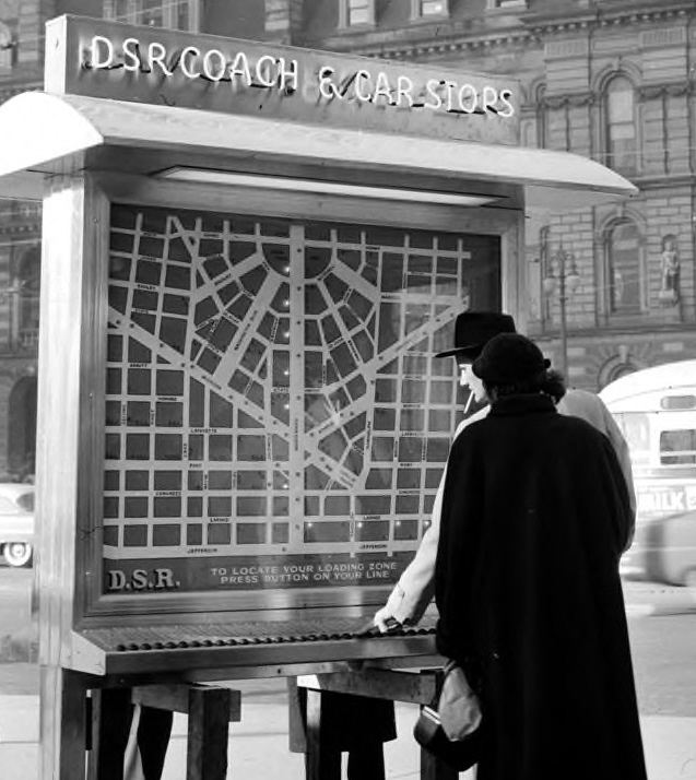
Built in house, at the DSR Coolidge Terminal, the seven-foot high illuminated display sign was encased in a shiny aluminum frame with a huge map displayed on each side. Each map was dotted with 244 small lights operated by 38 push buttons. These lights would light up to indicate all of the loading zone points on the map that corresponded to the individual route selected by a would-be patron. The unit was topped by a copper-colored neon sign that read "DSR Coach & Car Stops." According to the April 1955 edition of The DSR Reporter (a monthly employee newsletter), almost a half mile of wiring was used to hook up the push buttons and light sockets.
| . |
| This April 1, 1955, Detroit News photo shows a close-up view of the DSR's new "stop-finder" map sign that was located in Campus Martius. With just the push of a button, a would-be passenger's boarding stops would light up. (Walter P. Reuther Library, Wayne State University photo #29978 — used with permission) |
| Click here to return to "THE DSR YEARS" Main Page. |
| For Comments & Suggestions Please Contact Site Owner at: admin@detroittransithistory.info |
of the Walter P. Reuther Library, Wayne State University.
All rights, including those of further reproduction and/or publication,
are reserved in full by the Walter P. Reuther Library, Wayne State
University. Photographic reproductions may be protected by U.S.
copyright law (U.S. Title 17). The user is fully responsible for copyright
infringement.
for the above are courtesy of the Stan Sycko Collection.
| | | | |
Back in March of 1955, the Detroit Department of Street Railways (DSR) unveiled its own 1950s version of a modern day kiosk with the installation of its Service Robot Information Machine. This large electric illuminated "stop-finder" map � located in Campus Martius in Downtown Detroit � would show the perspective rider, at the push of a button, where to locate a downtown loading station for any DSR coach or car line. The rider could find their bus or streetcar loading zone by just pressing the button of the desired line and the corresponding downtown stops for that line would be illuminated on the large map.
According to the Monday, March 7, 1955 edition of the former Detroit Times newspaper, the DSR Commission had approved the installation of the $2,000 electric sign earlier that day. The huge sign, which displayed a large map of the downtown region, was up and running by the end of the month.
| . |
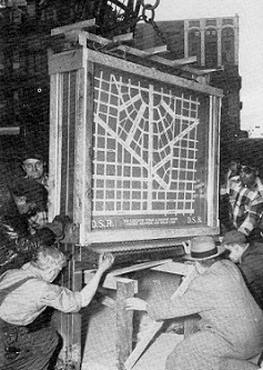
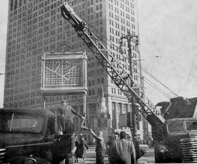
| These two photos show a DSR crew at work installing the huge electric sign at Campus Martius in downtown. The left photo shows the sign being swung into position by the DSR crane, while the right photo shows the crew guiding the sign into place onto a temporary wooden supporting framework. (Photos courtesy of the April 1955 edition of The DSR Reporter – An Employee Publication) |
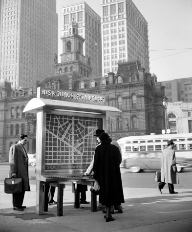
A far angle view of our top photo (seen here at right) shows where the Campus Martius sign was stationed within the small triangular-shaped block, known then as Campus Martius. Located just to the north of the intersection of Woodward and Monroe, the DSR map sat across the street from the old Detroit City Hall (visible in background). The old City Hall was demolished in 1961. Even though numerous route changes made after the streetcars were eliminated in 1956 resulted in the "stop-finder" map soon becoming outdated, the sign managed to survive through the mid-sixties.


| .. |
| The unique website which takes a detailed look back at the History of Public Transportation in and around the City of Detroit. |
| . |
| PRINTER- FRIENDLY WEB-PAGE |
| (Reformatted 12-21-13) |